The Strategic Geography and Maritime Setting of Ancient Corinth
During antiquity, the city-state of Corinth occupied a strategic position at one of the principal maritime and commercial crossroads of the Mediterranean Sea. To the east lay Kenchreai, Corinth’s primary harbour on the Saronic Gulf; to the west lay Lechaion, Corinth’s port on the Corinthian Gulf. Together, these two strategic ports enabled Corinth to directly regulate and tax maritime movement between the Aegean Sea, the Ionian Sea, and the wider western Mediterranean basin (Cook, 1979; MacDonald, 1986).
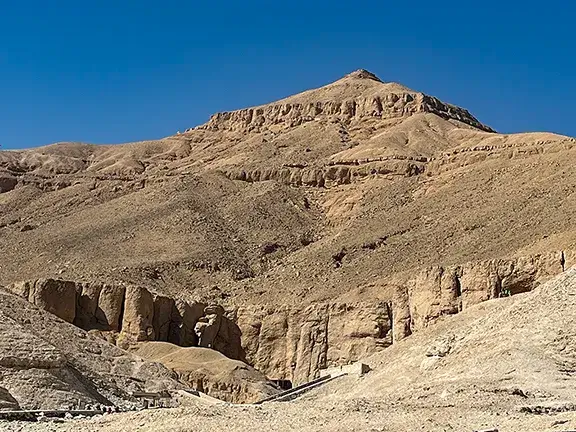
In the absence of an overland crossing across the Isthmus, ships travelling between the eastern and western seas were forced to circumnavigate the rugged Peloponnese, an arduous maritime route of approximately 185 nautical miles. This long passage included the rounding of Cape Malea, which ancient literary sources consistently associate with hazardous, unpredictable winds and violent currents. The geographer Strabo preserves the famous cautionary proverb, “Before you double Cape Malea, forget your home”, while Homer’s epic poem, the Odyssey, presents Cape Malea as the treacherous point at which the hero Odysseus is driven dangerously off course on his return voyage to the island of Ithaca (MacDonald, 1986).
Origins, Chronology, and Road Construction under Tyrant Periander
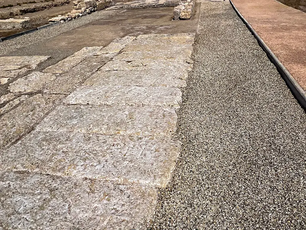
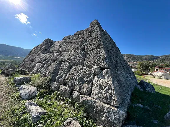
The construction of the Diolkos, whose name derives from the Greek words dia meaning “across” and holkos meaning “hauling”, is historically associated with the Corinthian tyrant Periander, who ruled during the late seventh and early sixth centuries BCE. Archaeological evidence, recovered during the systematic excavations conducted by Nikos Verdelis between 1956 and 1962, demonstrates that the infrastructure was a deliberately engineered, paved roadway built from substantial limestone blocks that generally measured between 3.5 and 5 metres in width (MacDonald, 1986; Pettegrew, 2011).
The trackway traversed the narrow Isthmus over an operational distance of approximately six to eight kilometres. Rather than adopting a strictly linear path, the course of the Diolkos followed the natural topographical contours of the landscape, maintaining a highly regulated, gentle gradient of approximately 1.5% to effectively facilitate the land portage of heavy cargo and vessels (MacDonald, 1986; Pettegrew, 2011).
Topographical Route and Coastal Termini of the Transisthmian Trackway
The Eastern Terminus: Schoinous and the Saronic Gulf Port of Kenchreai
The eastern terminus of the overland transit route lay near ancient Schoinous, located close to the modern Greek settlement of Kalamaki and situated a short distance north of the port of Kenchreai. This strategic location provided a practical maritime point of departure for the overland haul of vessels and goods while remaining securely within the commercial and defensive sphere of Corinth’s eastern harbour (Pettegrew, 2011).
The Western Terminus: Poseidonia and the Corinthian Gulf Port of Lechaion
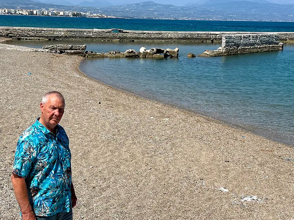
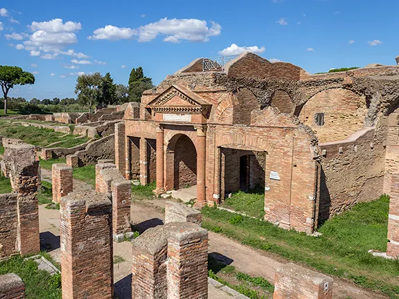
At its western terminus, the trackway approached Poseidonia, situated immediately beside the port of Lechaion and near the western entrance of the modern Corinth Canal. Preserved structural sections of the ancient limestone roadway are most visible in this coastal area. Near this western terminus, archaeologists identified a substantial stone-floored structure dating to the 3rd century BCE, which is generally interpreted by scholars as a maritime storage or logistics facility. Distinctive metal weights, historically known as stathmia, were recovered at the site alongside numerous ancient amphora fragments, indicating administrative activities associated with the commercial handling, weighing, and measurement of trade goods (MacDonald, 1986; Pettegrew, 2011).
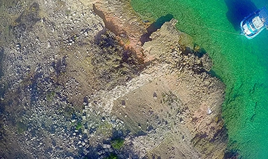
Adjacent stone platforms discovered during excavation may have facilitated the manual loading and unloading of the wheeled hauling vehicles, although a semi-submerged stone platform located further to the north has not yet been sufficiently investigated to permit definitive archaeological conclusions regarding its exact maritime function (Pettegrew, 2011).
Civil Engineering, Mechanical Architecture, and Operation of the Diolkos
The Paved Limestone Roadbed and Load-Bearing Infrastructure
The engineering and operational framework of the Diolkos relied on a robust, heavily engineered foundation to facilitate transisthmian transport during antiquity. The trackway was constructed from large, precisely fitted limestone paving blocks that provided an exceptionally stable and durable road surface across the Isthmus of Corinth. This specific form of stone construction significantly reduced the likelihood that the heavily loaded wheeled vehicles would sink into the softer alluvial ground when bearing the weight of commercial cargo, structural timber, or light warships (MacDonald, 1986; Pettegrew, 2011).
The Guided Wheel-Grooves and the Olkos Hauling Vehicle
Among the most distinctive technical features of the roadway is a pair of parallel grooves cut directly into the upper surface of the limestone paving stones and spaced approximately 1.5 metres apart. These precisely cut tracks directly guided the wheels of the olkos, the specialized wheeled platform used by ancient operators to transport heavy maritime loads across the terrain. By maintaining strict wheel alignment, these guide grooves reduced the risk of lateral shifting or derailment, particularly when navigating the path's curves or when the platform was carrying high, top-heavy, or unevenly distributed cargo loads (MacDonald, 1986; Pettegrew, 2011).
Historical Purpose: Commercial Utility vs. Military Warship Transshipment
Scholars and historians have extensively debated the primary operational function of the Diolkos, frequently characterising this paved limestone track as an ancient proto-railway due to its combination of a engineered roadbed, guided wheel-ruts, and regulated overland transit. Twentieth-century historical interpretations placed immense emphasis on the regular commercial transshipment of fully laden merchant vessels, arguing that generating toll revenues was the primary objective of the state. However, recent revisionist archaeological scholarship has questioned whether heavy, waterlogged merchant ships could have routinely traversed the steep, overland route with sufficient frequency for this demanding task to have constituted the installation's primary economic purpose (Cook, 1979; MacDonald, 1986; Pettegrew, 2011).
A more critical historical interpretation suggests that the Diolkos served multi-faceted, overlapping geopolitical and economic functions for ancient Corinth. The infrastructure facilitated the rapid overland portage of disassembled cargo, valuable raw materials, and unladen trade hulls, while concurrently providing a strategic mechanism for the cross-isthmus deployment of lighter military warships, such as classical triremes, during naval emergencies. In every operational capacity, the roadway actively reinforced the role of Corinth as a dominant, centralized commercial and logistical node within the wider Mediterranean trade network (Cook, 1979; MacDonald, 1986; Pettegrew, 2011).
Structural Decline, Seismic Impact, and Coastal Landscape Evolution
The long-term operational utility of the Diolkos was inextricably linked to the viability of the companion harbours of Lechaion and Kenchreai that the trackway interconnected. Over centuries, intense tectonic activity, severe coastal erosion, localized marine subsidence, co-seismic uplift, and catastrophic earthquake events radically altered the physical landscape of the Isthmus of Corinth. These continuous geological processes degraded both Lechaion and Kenchreai, progressively destabilising and weakening the vital maritime port infrastructure upon which the overland transit route depended (Minos-Minopoulos et al., 2015; Saitis et al., 2022).
Archaeological and sedimentological evidence recovered from Lechaion indicates multiple destructive episodes, including seismic liquefaction and high-energy tsunami activity, concentrating heavily during the 6th century CE. Coupled with significant long-term fluctuations in relative sea levels and the physical disruptions later introduced by modern canal excavations, these severe environmental pressures ultimately culminated in the terminal decline, structural ruin, and final abandonment of the ancient Diolkos transport route (Minos-Minopoulos et al., 2015; Saitis et al., 2022).
From Antiquity to Modernity: Roman Canal Schemes and the Modern Corinth Canal
The conceptualisation and ultimate execution of an artificial waterway cutting through the Isthmus of Corinth to replace the overland Diolkos spanned over two millennia, evolving from unsuccessful classical designs into the modern Corinth Canal to streamline Mediterranean maritime shipping. This ambitious engineering concept was first associated with the Corinthian tyrant Periander in the sixth century BCE, although the infrastructure project was reportedly abandoned following an unfavourable oracle from Delphi. The Macedonian king Demetrius Poliorcetes reconsidered the canal scheme in the 3rd century BCE, but his civil engineers are said to have feared that a sea-level channel might catastrophically inundate the low-lying islands of the Saronic Gulf (Stiros, 2007).
In the 1st century CE, the Roman statesmen Julius Caesar and Caligula also evaluated the construction of a canal, but physical excavation only commenced under the Roman Emperor Nero in 67 CE. The historian Suetonius records in The Twelve Caesars that Nero personally initiated the physical work with a golden pickaxe on the 28th of November 67 CE before assigning thousands of Judean prisoners of war from the Roman province of Judaea to the gruelling excavation project. The entire imperial undertaking was abruptly abandoned following Nero’s death the following year in 68 CE (Suetonius, n.d.; Stiros, 2007).
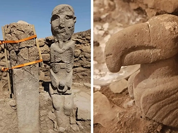
One surviving archaeological trace of Nero’s ancient engineering project is the so-called “Nero’s Relief”, a temple-shaped stele carved directly into the southern limestone rock face of the canal channel. The rock relief depicts the mythological hero Heracles adorned with a lion skin and wielding a club, although the exact iconographic interpretation remains highly uncertain among scholars. The monument has been variously understood as an idealized image of Nero in the guise of Heracles or as a protective religious shrine intended to safeguard the ancient canal workforce (Stiros, 2007).
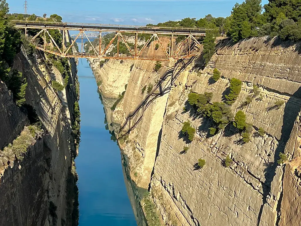
The modern Corinth Canal was officially initiated on the 22nd of April 1882 and successfully completed in 1892. In stark contrast to the winding, topographical alignment of the ancient Diolkos, the modern engineering work follows a strictly linear course extending approximately 6.3 kilometres directly across the narrow neck of land. The functional canal measures approximately 44 metres in width and 8 metres in depth, flanked by steep rock walls rising up to 90 metres above relative sea level (Stiros, 2007).
Author’s Note
Historical researcher and author Nick Nutter’s scholarly analysis of the ancient Greek trackway draws on more than 25 years of firsthand archaeological exploration across the Mediterranean basin. The detailed topographical observations and structural assessment of the Diolkos were further informed by dedicated archaeological fieldwork undertaken throughout the Argolid Peninsula, a historical region of modern Greece, and the eastern Peloponnese during June 2026.