Late Bronze Age Miletus: Mycenaean Trade and the 1200 BCE Collapse
Around 1200 BCE, the Late Bronze Age collapse transformed the eastern Mediterranean, bringing about the destruction of the Hittite Empire and the Mycenaean palatial centres. Miletus was likewise destroyed in this upheaval, and its Bronze Age trading network disintegrated. For nearly four centuries thereafter, Miletus no longer functioned as a major maritime centre (Bryce, 2005; Niemeier, 1998).
The Ionian Migration: Archaic Miletus and the Black Sea Trade Network
Following its destruction at the close of the Bronze Age, the site appears to have remained largely abandoned until the Ionian migration, conventionally dated to around 1050 BCE. Both literary tradition and archaeological evidence indicate that Greek settlers, chiefly from the mainland and especially Athens, arrived in the mid-11th century BCE. Their settlement marked the re-emergence of Miletus and the beginning of its ascent as a major Ionian centre (Gorman, 2001).
Resettled during the Ionian migration, Miletus entered a period of expansion in the Archaic era (8th to 6th centuries BCE). Its deep-water harbours, together with renewed access to the Anatolian interior through the Maeander River valley, enabled Miletus to emerge as the pre-eminent maritime power on the Ionian coast (Greaves, 2002; Gorman, 2001).
During this period, Miletus reoriented its commercial activity northwards. The city is traditionally credited with founding as many as ninety colonies around the Sea of Marmara and the Black Sea, including Sinope (modern Sinop, Turkey,Abydos, and Olbia (modern Ukraine (Roebuck, 1959). This colonial network supplied Mediterranean markets with grain from the Pontic steppes, timber, slaves, and salted fish, while Miletus exported textiles, wine, and olive oil (Roebuck, 1959; Greaves, 2002). The wealth generated by these exchanges also underpinned the city's intellectual prominence, most notably in the emergence of the Milesian school of philosophy and figures such as Thales and Anaximander (Gorman, 2001; Greaves, 2002).
Classical Miletus: The Ionian Revolt, Persian Destruction, and Rebuilding
Miletus's wealth and strategic significance also rendered it vulnerable. During the Ionian Revolt against the Achaemenid Persian Empire (centred in modern Iran), the city became the principal centre of the rebellion. Following the naval defeat at Lade (an ancient island now situated as a hill in the alluvial plain), in 494 BCE, Persian forces sacked Miletus, killing or enslaving much of its population and burning the sanctuary of Apollo at Didyma (modern Didim, Turkey (Greaves, 2002).
The city was liberated by the Greeks in 479 BCE and subsequently rebuilt on a strict orthogonal grid plan traditionally associated with Hippodamus. Throughout the Classical and Hellenistic periods, Miletus remained an important commercial centre, adapting to the successive hegemonies of Athens, Alexander the Great, and the Hellenistic dynasties. By the 3rd century BCE, one of its principal harbours had come to be known as the Harbour of Lions (Greaves, 2002; Gorman, 2001).
Classical Miletus: The Ionian Revolt, Persian Destruction, and Rebuilding
Miletus's wealth and strategic significance also rendered it vulnerable. During the Ionian Revolt against the Achaemenid Persian Empire (centred in modern Iran), the city became the principal centre of the rebellion. Following the naval defeat at Lade (an ancient island now situated as a hill in the alluvial plain, in 494 BCE, Persian forces sacked Miletus, killing or enslaving much of its population and burning the sanctuary of Apollo at Didyma (modern Didim, Turkey (Greaves, 2002).
The city was liberated by the Greeks in 479 BCE and subsequently rebuilt on a strict orthogonal grid plan traditionally associated with Hippodamus. Throughout the Classical and Hellenistic periods, Miletus remained an important commercial centre, adapting to the successive hegemonies of Athens, Alexander the Great, and the Hellenistic dynasties. By the 3rd century BCE, one of its principal harbours had come to be known as the Harbour of Lions (Greaves, 2002; Gorman, 2001).
The Lion Harbour of Miletus: Naval Defences and Civic Monuments
The Harbour of Lions, functioning as the primary naval and commercial port of ancient Miletus during the 3rd century BCE, derived its name from two monumental marble lion statues positioned at the narrowest point of the harbour entrance. These statues served crucial defensive and civic purposes, anchoring the city's maritime security and projecting its cultural power (Brückner et al., 2014; Gorman, 2001).
- Military defence: As the city's principal naval harbour, the Harbour of Lions required substantial fortification. The statues appear to have functioned as anchor points for a heavy iron boom chain, which could be raised in times of war or impending attack to obstruct hostile vessels (Brückner et al., 2014).
- Civic symbol: The lion was the traditional civic and religious emblem of Miletus and was closely associated with Apollo Didymaeus, the city's patron deity. The placement of two colossal lions at the entrance to the harbour projected Milesian identity, authority, and prestige to those arriving by sea. The effect would have been heightened by the presence of several of the city's principal monuments around the basin (Gorman, 2001; Greaves, 2002):
- The Delphinion: The central sanctuary of Apollo Delphinios (the protector of ships and harbours) sat right on the edge of the harbour basin.
- The Harbour Stoa: A massive, colonnaded marketplace wrapped around the waterfront, where merchants unloaded goods directly into the city's commercial centre.
- The North Agora: One of the main civic squares of the city was situated immediately adjacent to the harbour's southern edge.
A vessel passing between the lions and beneath the boom chain was therefore not arriving at a peripheral outpost, but at the urban and ceremonial core of Miletus (Brückner et al., 2014; Greaves, 2002).
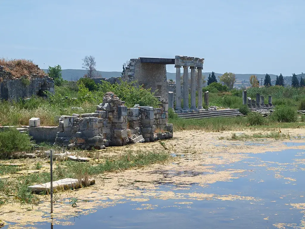
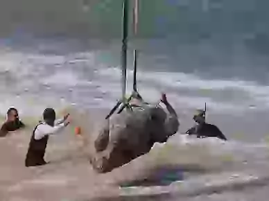
Although the harbour is now entirely silted over beneath the Anatolian floodplain, archaeologists have identified the remains of the statues. One lion survives in relatively good condition, whereas the other was recovered in fragments (Brückner et al., 2014).
Roman Miletus: Monumental Development and the Mediterranean Grain Trade
Under Roman rule, Miletus underwent renewed monumental development while retaining its status as a prosperous provincial port and an important node in the Mediterranean grain trade (Greaves, 2002).
The Environmental Demise of Miletus: Maeander River Silt and the Landlocked Port
Unlike many ancient cities whose decline resulted primarily from conquest, the ancient port of Miletus was ultimately undermined by environmental change. From the Bronze Age onward, the Maeander River (Büyük Menderes) transported vast quantities of silt from the Anatolian highlands to the coast, gradually infilling the Latmian Gulf (Brückner et al., 2006).
By the Late Roman and Byzantine periods (circa 4th to 15th centuries CE), the once-deep harbours of Miletus had become marshy and increasingly difficult to navigate. Miletus's connection to the sea, the basis of the city's prosperity for more than two millennia, was progressively severed (Brückner et al., 2006). Malaria became established in the resulting swamplands, and the local population declined steadily. By the Ottoman period, the former maritime power had been reduced to the small inland village of Balat, nearly 10 kilometres from the modern coastline. Miletus was not so much conquered as stranded, its theatres and temples left marooned in alluvial mud.
Geoarchaeology of the Lost Naval Shipyards of Ancient Miletus
Historical and literary sources strongly indicate that the ancient port of Miletus was one of the major shipbuilding centres of the ancient world during the Archaic and Classical periods, yet direct archaeological evidence for its shipyards remains elusive due to millennia of sedimentary infill (Greaves, 2002; Blackman, 1982).
This discrepancy between the historical record and the archaeological evidence constitutes one of the most significant interpretive problems in the study of Miletus. The available evidence may be divided into three main categories (Greaves, 2002; Brückner et al., 2014).
Historical Evidence for Milesian Triremes and Colonial Shipbuilding
The scale of Miletus's maritime activity strongly implies the existence of substantial shipbuilding infrastructure. The clearest indicators are as follows (Roebuck, 1959; Herodotus, 1920; Greaves, 2002):
- The Colonial Fleet: During the Archaic period, Miletus reoriented its commercial activity northwards. Between c. 750 BCE and 550 BCE, it founded up to ninety colonies across the Sea of Marmara and the Black Sea (Roebuck, 1959). Sustaining this level of expansion would have required a highly organised, large-scale shipbuilding sector capable of producing both merchant vessels and exploratory ships (Roebuck, 1959; Greaves, 2002).
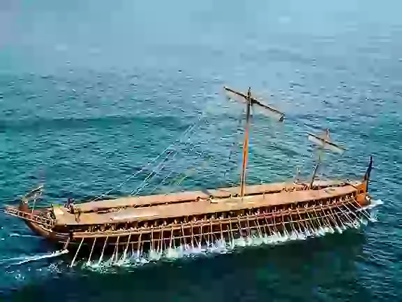
- The Trireme Fleet: During the Ionian Revolt, Miletus contributed an impressive 80 triremes to the Greek allied fleet at the Battle of Lade in 494 BCE (Herodotus, 1920, 6.8; Greaves, 2002). Triremes were highly specialised, expensive warships that could not be left in the water for extended periods without becoming waterlogged and vulnerable to shipworm. They therefore required dedicated, roofed slipways known as neosoikoi (shipsheds), where they could be hauled out, dried, and repaired (Blackman, 1982).
- Access to Materials: Miletus was perfectly positioned to exploit the vast timber resources of the Anatolian interior, moving wood down the Maeander River directly to its coastal shipwrights (Greaves, 2002).
Archaeological Challenges: The Alluvial Burial of the Milesian Harbours
Despite this naval output, archaeologists have yet to identify the monumental ship-shed complexes attested at other major maritime centres such as Piraeus (the modern port of Athens, Greece, Carthage (modern Tunis, Tunisia, or Rhodes (Blackman, 1982; Greaves, 2002). The principal explanations are geographical and historical (Brückner et al., 2006; Greaves, 2002):
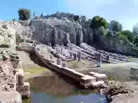
- The Maeander's Alluvial Blanket: The very river that brought wealth to Miletus also buried it. The continuous progradation of the Büyük Menderes (Maeander) River silted up the Latmian Gulf. Today, the ancient harbours of Miletus, such as the famous Harbour of Lions and the Theatre Harbour, are buried under several metres of alluvial mud and agricultural land (Brückner et al., 2006). Finding wooden or stone slipways buried under a high water table in swampy conditions is incredibly difficult.
- Continuous Overbuilding: Because Miletus remained a prosperous Roman and Byzantine city, its waterfront was continually renovated. The construction of Roman-era monuments, such as the grand Harbour Stoa, likely obliterated or was built directly over the fragile Archaic and Classical shipyard infrastructure (Greaves, 2002).
- The Persian Sack: Following the Battle of Lade, the Persians sacked and burned Miletus. Any timber-built dockyards or early shipsheds would therefore have been especially vulnerable to destruction (Herodotus, 1920, 6.19; Greaves, 2002).
Modern Geoarchaeological Coring at the Harbour of Lions
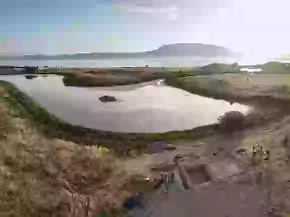
In recent years, the search for Miletus's lost shipyards has shifted away from conventional excavation towards geoarchaeological investigation. Researchers have extracted deep vibracores around the Harbour of Lions in order to reconstruct ancient bathymetry and identify the shorelines of the Classical and Hellenistic periods (Brückner et al., 2014).
These investigations have identified ancient harbour basins and traces of heavy-metal pollution associated with maritime activity. Nevertheless, the slipways, dry docks, and neoria (naval dockyards) that once supported the Milesian fleets remain concealed beneath the Anatolian floodplain (Brückner et al., 2014).