The Tin Roads
Brittany to the Middle East
Western Europe’s earliest long-distance tin routes grew from the river valleys and alluvial deposits of Brittany. By the late third millennium BCE, miners were extracting cassiterite and moving it south along river corridors towards the Mediterranean (Briard 1979; Broodbank 2013).
The Armorican Source: Alluvial Tin
Unlike primary hard-rock deposits that required miners to drive claustrophobic shafts into unyielding granite, Brittany possessed exceptionally rich, shallow alluvial placer deposits (Giot et al. 1998). Over deep geological time, heavy rains and river action eroded the cassiterite-bearing quartz veins of the Hercynian massif, depositing dense, water-rounded tin-dioxide pebbles directly into river gravels and floodplain sediments.
Early extraction of these pebbles occurred in two primary mining zones:
- The Abbaretz-Nozay Complex: Located in modern Loire-Atlantique, just north of the Loire River estuary, this expansive placer field allowed prehistoric workers to harvest raw cassiterite with minimal technology. Using simple wooden pans, sluices, and water-washing techniques, early miners separated the heavy tin pebbles from surrounding sands without crushing host rock (Briard 1979).
- The Morbihan and St. Renan Placers: Clustered along the southern and western Breton coasts, these riverine deposits yielded easily accessible cassiterite that fuelled the explosive rise of the Armorican Tumulus Culture (c. 2100–1800 BCE).
The chieftains of this early Bronze Age culture grew wealthy on their material monopoly. Their grand burial mounds (tumuli) have yielded exceptional grave goods: polished stone maces, gold-sheathed daggers, and bronze blades alloyed with local tin, material proof of a society operating at the cutting edge of early European pyrotechnology (Briard 1979; Giot et al. 1998).
The Loire–Rhône Axis
It is tempting to imagine Breton sailors carrying tin directly around the Bay of Biscay. A more practical route used rivers, short coastal passages and overland portages. These stages reduced exposure to open water and allowed cargoes to pass between local carriers (Cunliffe 2001, 2008).
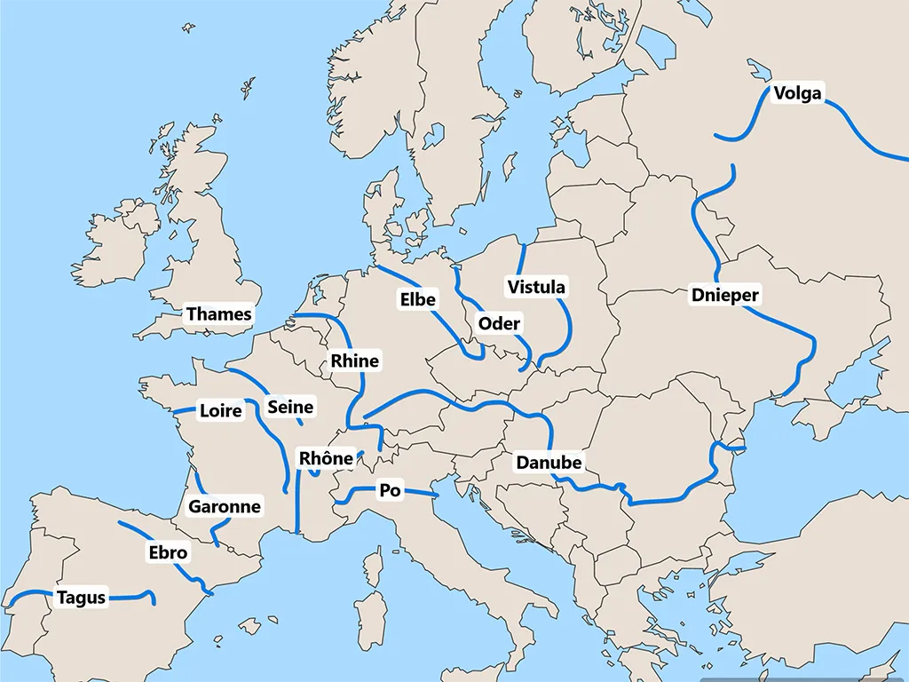
Instead, the movement of Breton tin relied on a sophisticated combination of riverine transport (cabotage) and short overland portages across continental France:
- The Riverine Ascent (The Loire): Harvested tin pebbles or roughly smelted tin ingots were loaded onto river dugouts and hide boats at the mouth of the Loire River. Traders navigated eastward, ascending the gentle gradient of the Loire valley into the heart of France.
- The Continental Divide (The Central Portage): Near modern Roanne and Lyon, the upper reaches of the Loire River flow within a short distance of the Saône and Rhône river systems. Here, at a low-elevation gap in the topography, porters offloaded the heavy metal cargoes, carrying them across the narrow watershed on foot or via pack animals (Cunliffe 2001; Sherratt 1993).
- The Mediterranean Descent (The Rhône): Re-embarked onto river craft floating down the Saône and Rhône, the tin travelled rapidly southward, emerging into the salt waters of the Gulf of Lion near modern Marseille and the Languedoc coast.
An alternative southern bypass, the Carcassonne Gap, offered a secondary artery. Traders moved tin down the Atlantic coast to the Gironde estuary, paddled up the Garonne River, portaged through the natural depression of Carcassonne, and descended the Aude River to reach the Mediterranean near Narbonne (Cunliffe 2001).
Entering the Mediterranean
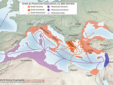
Upon reaching the Mediterranean littoral at the Gulf of Lion, Breton tin entered a complex, highly fragmented maritime environment. Long before the rise of Mycenaean palatial fleets or Phoenician long-distance networks, trade across the Western and Central Mediterranean operated through down-the-line cabotage (Broodbank 2013; Pare 2000).
Small coastal craft carried the metal eastward along the Ligurian coast, filtering it down through the Tyrrhenian Sea via an “island bridge”:
- Corsica and Sardinia: Acting as stepping stones, these islands absorbed early tin, blending it with local Tyrrhenian copper deposits.
- Sicily and the Ionian Sea: From the southern tip of Italy and Sicily, trade routes crossed the narrow sea lanes into the Ionian basin.
By the late third millennium BCE (c. 2300–2000 BCE), this trickle of Atlantic-derived tin reached the Early Cycladic III and Early Minoan II–III communities of the Aegean, before continuing onward to the coastal emporia of the Levant and the Near East (Sherratt 1993). While total volumes were modest by modern standards, this early flow supplied the critical threshold of tin required to ignite true “bronzisation” across the eastern Mediterranean basin, centuries before Central Asian hard-rock mines or Cornish alluvial fields were fully integrated into the global palatial supply chains (Berger et al. 2019; Williams et al. 2025).
Central Asian Routes: The Spice Road and the Karum
While western tin moved through river corridors, Central Asian tin entered Near Eastern and Mediterranean systems through overland routes across Iran and Mesopotamia. Two routes were especially important:
The Southern Route
Elamite and Zagros networks carried tin toward Susa and Babylon, then up the Euphrates to Emar, a major inland trading point. The Diviner’s Archive at Emar indicates that private merchant families managed parts of this trade independently of royal palace control (Rutz 2013). From Emar, tin moved by donkey caravan to Ugarit, where it could be shipped into the Mediterranean. The entire trek would take up to seven months.
Emar was situated at the great western bend of the Euphrates River. It functioned as the ultimate inland transshipment hub (or “dry port”). Riverboats carrying tin and textiles from Babylonia and the East travelled up the Euphrates to Emar. There, the cargoes were offloaded, weighed, taxed, and repacked onto donkey caravans bound for the Mediterranean port of Ugarit or the Hittite heartland of Anatolia [Turkey].
This route was vulnerable to the nomadic Sutean and Ahlamu (early Aramean) tribes who raided caravans, eventually severing the link as central authority faded. If Elam was hostile towards Babylon, as it often was, the southern route was blocked, forcing trade north towards Assyria.
The Diviner’s Archive at Emar
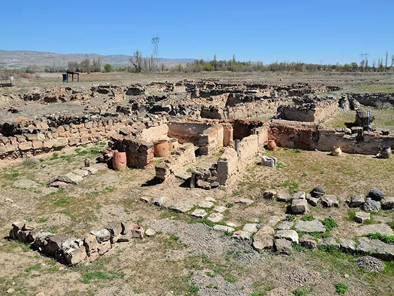
The Diviner’s Archive at Emar (modern Tell Meskene in northern Syria) is one of the most significant cuneiform discoveries of 20th-century Middle Eastern archaeology. Uncovered during French salvage excavations in the mid-1970s prior to the flooding of Lake Assad, it represents the private personal and professional library of a family of high priests who served as the “Chief Diviners of the Gods” (LÚ.HAL) during the 13th and early 12th centuries BCE (Rutz 2013).
While the archive’s primary religious contents—ritual texts, omen series, and sacrificial calendars—have reshaped our understanding of Late Bronze Age Syrian religion, its administrative and legal documents offer an extraordinary window into the mechanics of the ancient tin trade.
The archive belonged to a prominent dynasty of diviners, most notably a patriarch named Zu-Ba'la and his descendants (including his son Ba'al-qarrad). Although their official title was religious (responsible for interpreting divine omens, performing extispicy, and overseeing cultic festivals), the tablets reveal that Zu-Ba'la and his family operated as high-level, private commercial entrepreneurs. They used their elite status and wealth to function as major financiers and logistics managers for international trade.
The legal texts, promissory notes, real estate deeds, and commercial correspondence found within the Diviner's Archive provide several insights into how the tin trade actually operated on the ground:
- Private Enterprise vs. State Control: Unlike the rigid, state-monopolized trade seen in Mycenaean palaces, the trade at Emar was driven by private mercantile firms (houses). Men like Zu-Ba'la acted as independent brokers, extending loans, buying up property, and financing trade missions.
- Credit and Financing: The archive contains numerous loan documents where the Diviner lent silver or grain to merchants setting out on trade routes, taking tin, land, or even family members as collateral.
- The Sutean Threat: The tablets document the constant security risks facing the tin caravans. Letters in the archive detail raids by nomadic Sutean and Ahlamu tribes who targeted the trade routes along the Euphrates, forcing the diviners to pay protection money or hire armed escorts to ensure the metal reached its destination.
The Diviner’s Archive came to a sudden, dramatic end around 1187 BCE. The final dated tablets in the archive talk about a city under siege, experiencing severe famine as the broader Late Bronze Age collapse swept through the region. Enemy forces, likely related to the roving sea and land raiders sweeping the Levant, captured and burned Emar. The roof of the Diviner’s house collapsed, baking the clay tablets in the conflagration and unintentionally preserving this extraordinary record of the ancient tin roads for over three thousand years.
The Northern Route
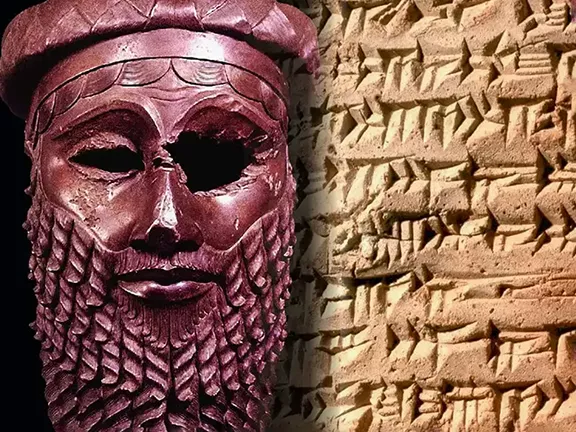
When southern corridors were blocked, trade shifted toward Old Assyrian merchant colonies, or karum. Between 1975 BCE and 1750 BCE, Assyrian families organized caravans from Assur to Kültepe-Kanesh in Anatolia [Turkey]. More than 23,500 cuneiform tablets from Kanesh record the scale of this system, including caravans of 200 to 250 donkeys, each capable of carrying about 60 kilogrammes of tin (Dercksen 2004; Liverani 1990).
The northern transit route was highly seasonal. The high passes of the Taurus Mountains were completely blocked by snow between December and early April, forcing caravans to pause or time their departures for late spring. The entire journey, assuming no delays, would take up to six months.
As an illustration of scale, Liverani’s analysis of Old Assyrian trade shows that a single large caravan of 250 donkeys could move up to 15 tonnes of tin, a quantity roughly equivalent to the estimated total annual tin requirement for all the palatial centres of the Late Bronze Age Eastern Mediterranean combined.
Each donkey caravan probably carried far less tin and would have consisted of a mixed cargo of exotica.
Operational Constraints
- The “Down-the-Line” Reality: A single donkey driver rarely made the entire 6-month journey from Central Asia to the Mediterranean. Cargoes changed hands at major intermediate emporia (such as Assur, Susa, Mari, or Emar), where tin was offloaded, re-weighed, taxed, and repacked onto new caravans.
- Stationary Delays: Administrative holds at city gates, tax negotiations (awītum duties), rest days for animals, and waiting for river ferry crossings or seasonal weather windows often added 25% to 50% more time to the basic marching schedule.
Cornish Tin Movement by River, Coast, and Portage
The movement of western tin has often been imagined as a direct sea voyage from Cornwall to the Mediterranean. That picture is dramatic, but unlikely.
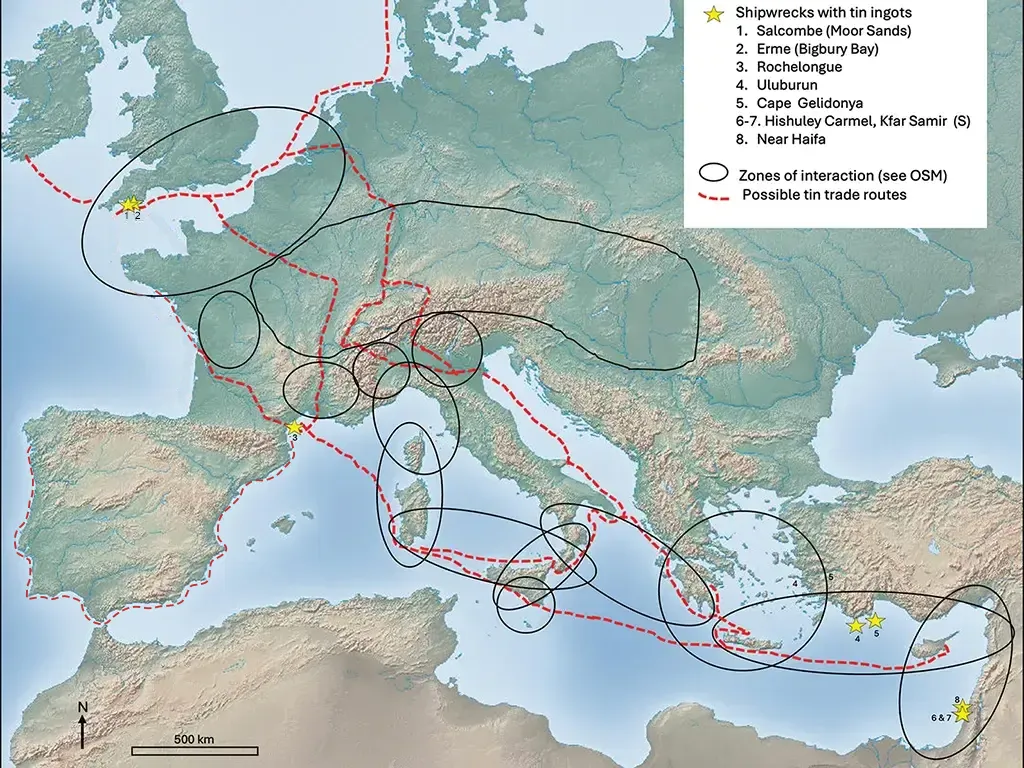
Before advanced sailing technology, ships relied on oars, simple square sails, and light hulls. A direct journey across the Western Approaches and around the Bay of Biscay would have been dangerous and impractical. A staged route is more plausible. Coastal craft could move up the Channel in short legs, cross the Channel at its narrowest point, Dover, while river systems and brief portages then carried metal across the continent.
Regional gateways such as Langdon Cliff and Salcombe show strong cross-Channel connections through mixed cargoes of metal and finished objects (Needham et al. 2013; Penhallurick 1986).
Four shipwrecks may give us a clue to the route the Cornish tin was taking:
- Langdon Cliff (c. 1100 BCE): The Langdon Cliff wreck site is at the foot of Langdon cliff just east of Dover, within sight of the French coast, and consists of a collection of artefacts, including tools, weapons, and ornaments made in France. These items have been dated to 1100 BCE. Over 350 artefacts have been recovered to date. Again, the bronze originated in northern France. Some of the pieces had been cut up perhaps for use as scrap to be re-smelted (Needham et al. 2013).
- Salcombe A (800–700 BCE): The wreck known as Salcombe A carried bronze swords and rapiers dating to between 1300 and 1150 BCE, rapier blade fragments and palstaves (bronze axes) dated to the same period and a carp's tongue sword dated to between 800 and 700 BCE. Notice this wreck is carrying bronze weapons that are already up to five hundred years old.
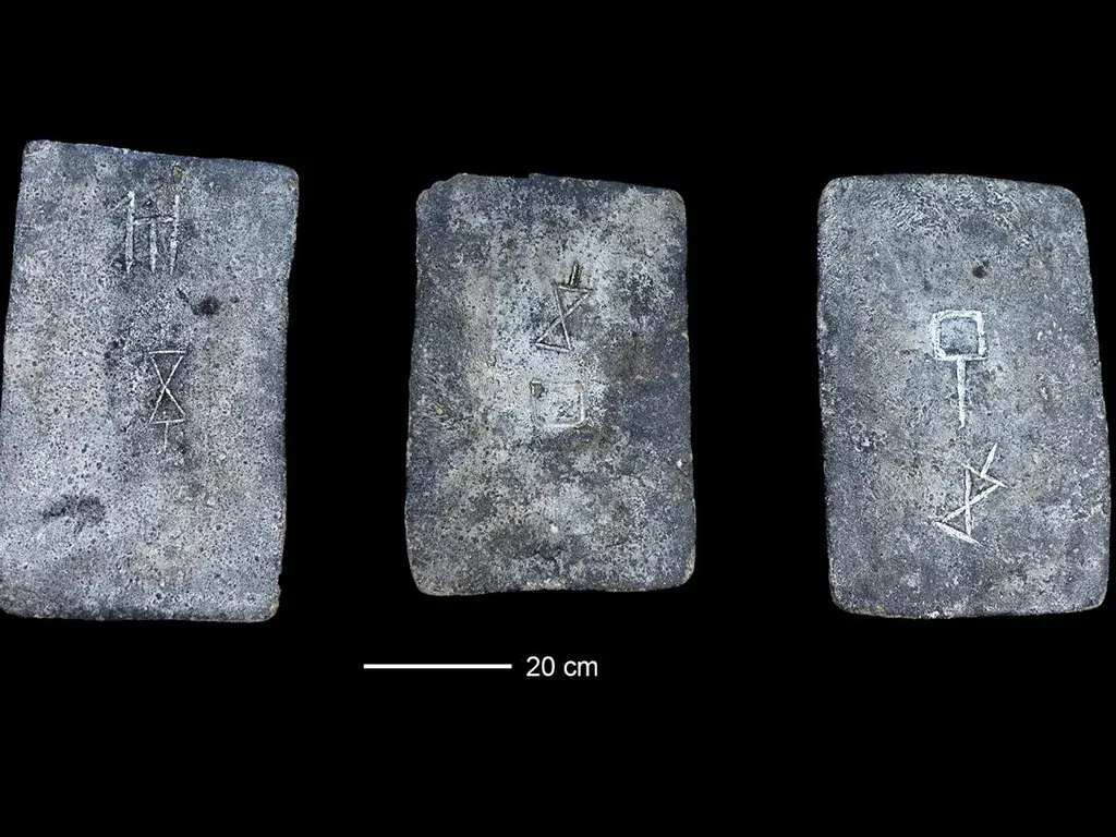
- Salcombe B (800–700 BCE): Carried a massive load of copper and tin ingots. The copper was analysed and came from a metalworking site in Switzerland. The cargo also included an object made in Sicily, called Strumento con Immanicatura a Cannone [having a cannon-shaped handle], which, as yet, has no known purpose. The Strumento is dated to between 1200 and 1100 BCE and is currently displayed in the British Museum.
- Bigbury Bay: The third wreck site is in Bigbury Bay in south Devon, 5 kilometres northwest of Salcombe. Its cargo was tin ingots in the shape of knuckle bones and probably represented tin being taken from Cornwall to the continent. This vessel was apparently on the outward journey although when it foundered is not known; it could have been during the Bronze Age or later.
Once the cargo was on the continent, rivers became the highways. The Loire, Seine, Rhône, Rhine, and Danube form a dense communication zone north of the Alps. Tin from Cornwall could cross to northern France, move inland along the Rhine, pass by portage into the Rhône system, and reach the Gulf of Lion without requiring an open Atlantic voyage. From there, long established maritime trade routes allowed the tin to travel to Sardinia and Sicily, along to the Aegean palatial networks and into the Levant. The journey from the Rhône onwards had been well travelled by tin from Brittany for over one thousand years by this stage. The Rhine – Danube corridor also allowed access to the Black Sea, eastern Mediterranean, and Middle East bypassing the Mediterranean cabotage, an intriguing alternative route that requires more study.
The Rhine – Danube Corridor
While the Loire–Rhône corridor served as the primary riverine artery into the Western Mediterranean, the Rhine–Danube Trans-European Corridor formed a parallel eastbound river highway. This trans-continental network linked the North Sea and English Channel watersheds, fed directly by British and Breton tin, across Central Europe to the Black Sea, funnelling Atlantic metal directly toward northwestern Anatolia [Turkey], the Levant, and the Aegean.
River Geography and Portage
The viability of this route rested on a unique hydrological alignment. In southern Germany, near the Black Forest and Swabian Jura, the upper tributaries of the Rhine (such as the Main and Neckar) flow within a short overland distance of the headwaters of the Danube. By ascending the Rhine and executing a brief overland portage across this narrow continental divide, river craft could enter the Danube, a continuous, 2,800-kilometre liquid highway flowing eastward directly into the Black Sea.
Companion Goods: Amber and Gold
Because unworked tin ingots were routinely melted down, archaeologists trace the vitality of the Rhine–Danube highway through companion prestige goods that travelled the same paths:
- Cornish Gold in Central Europe: Isotope testing on Early and Middle Bronze Age artifacts, most famously the gold accents on the Nebra Sky Disc (c. 1600 BCE) found in Saxony-Anhalt, demonstrates that Cornish gold travelled eastward along these river valleys alongside Atlantic tin. Matching gold and tin signatures appear in hoards scattered along the Danube throughout modern Hungary and Romania.
- The Amber Pipeline: High-value Baltic amber moved southward along the Elbe and Rhine, merging at the upper Danube with east-bound tin shipments to feed palatial demand in the Aegean and Near East.
Metallurgical Hubs
Recent multi-isotope research by groups such as the Curt-Engelhorn-Zentrum Archäometrie (CEZA) confirms that during the Middle and Late Bronze Age (c. 1500 – 1100 BCE), the Alpine foreland and upper Danube functioned as a major metallurgical processing and redistribution zone. Here, Atlantic tin was alloyed with Alpine copper and redistributed east toward the Black Sea. Further downriver, copper “oxhide” ingots and tin finds along the Bulgarian coast (e.g., Sozopol and Cape Kaliakra) confirm that Black Sea maritime hubs were actively linked to Danubian river trade.
Black Sea Gateways
Shipwreck sites along the English Channel, such as Langdon Cliff (Dover) and Salcombe (Devon), contain mixed cargoes of Atlantic tin, British bronzes, and Continental artifacts, illustrating how coastal ports continually fed raw metal to the mouth of the Rhine.
Once metal descended the Danube to its delta, cargoes were offloaded onto coastal craft sailing south through the Bosporus and Dardanelles. This allowed Cornish and Breton tin to enter major regional centres like Troy and the Mycenaean northern networks without ever traversing the Western Mediterranean.
The Galician Paradox
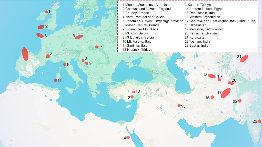
Galicia and northern Portugal held some of Europe’s richest and most accessible alluvial cassiterite deposits. In practical terms, these sources should have offered Mediterranean traders a shorter route than that from Britain.
Yet isotope evidence suggests that, during the palatial peak of the Late Bronze Age, Galician tin is almost absent from Eastern Mediterranean contexts (Williams et al. 2025). Tin ingots from the Hishuley Carmel wrecks off Israel and the Uluburun wreck off Turkiye [Turkey] instead point to Cornwall, Devon, and Central Asia, not Spain (Berger et al. 2023; Powell et al. 2022). Trace-element analysis, combined with tin and lead isotope testing, showed that the Late Bronze Age ingots from the Levantine seabed had high indium signatures and a geological formation age of 274–293 million years. Those values match the granite batholiths of Cornwall and Devon and rule out older ore bodies in Central Europe or Iberia.
Two factors help explain this paradox:
- Entrenched British supply networks: Cornish tin had already become embedded in established continental exchange systems before the height of Mycenaean palatial power.
- Palatial control of trade: Late Bronze Age exchange was shaped by institutional monopolies, elite gift-giving, and trusted brokers. Mycenaean and Middle Eastern palaces worked through long-standing intermediaries along secure French and German river corridors, while the decentralized communities of Bronze Age Galicia remained outside those channels.
Galician tin found its own niche in the more local, confusingly named, Atlantic Bronze Age.
Atlantic Bronze Age in the Iberian Peninsula
Archaeologists use the term ‘Atlantic Bronze Age’ for the cultural connections that linked Ireland, Britain, France, Portugal and Spain during later prehistory. Adolf Mahr introduced ‘Atlantic’ as a cultural label in 1937, rather than merely a geographical description (Mahr 1937).
Shared objects and technologies show substantial contact across this broad zone, but the routes were not a single coastal highway. Networks linking Ireland and Cornwall to continental Europe differed from those connecting Galicia, Portugal and the Strait of Gibraltar. Iberian exchange therefore developed partly on its own terms.