Climatic Events that Changed the World
The Desertification of the Sahara Desert after 4000 BC
The Desertification of the Sahara occurred over a long period of time with a starting surge lasting one thousand years and continuing at a slower rate to this day. The population in what is now the desert had ample time to adapt to the changing conditions. The desertification continues to this day and we take a look into the future of the Sahara region.
By Nick Nutter on 2024-01-18 | Last Updated 2025-05-20 | Climatic Events that Changed the World
This article has been visited 14,453 times

The Sahara Desert
The Sahara is a desert spanning North Africa. With an area of 9,200,000 square kilometres, it is the largest hot desert in the world and the third-largest desert overall, smaller only than the deserts of Antarctica and the northern Arctic.
The desert covers much of North Africa, excluding the fertile region on the Mediterranean Sea coast, the Atlas Mountains of the Maghreb, and the Nile Valley in Egypt and the Sudan.
It stretches from the Red Sea in the east and the Mediterranean in the north to the Atlantic Ocean in the west, where the landscape gradually changes from desert to coastal plains. To the south it is bounded by the Sahel, a belt of semi-arid tropical savanna around the Niger River valley and the Sudan region of sub-Saharan Africa.
Do you enjoy my articles? For your reading pleasure, this website does not carry third party ads. You could help me write more articles by buying me a cup of coffee.
The Sahara before 4000 BC


The Sahara as it was before 4000 BC
Between about twelve thousand years ago and 4000 BC, the Sahara was covered by grasses, trees and lakes. Big game roamed the savannah and hunter gatherers and pastoralists lived an easy life, unaffected and having no need or desire for the Neolithic lifestyle adopted by the people to the north of the Mediterranean basin and east of the Nile. Up to about 3500 BC, Lake Mega-Chad measured over 350,000 square kilometres, bigger than the Caspian Sea, currently the world's largest lake. Lake Mega-Chad was just one of several massive paleo-lakes in Africa, such as Lake Fezzan, Lake Turkana, and Lake Chotts. A vast system of wadis, particularly in what is now Libya, irrigated the land.
All that was to change over a period of about one thousand years after the monsoon belt, also called the tropical rain belt, started to slip south around 4000 BC. Conditions over North Africa and Arabia became warmer and much drier. By 3000 BC, the lakes were reduced to salt flats and the wadis were dry. The Sahara had become a true desert.
The Desertification Process


The Sahara Today
The desertification process was by no means even. In the east, water level in the lakes started to drop just before 4000 BC. In southern Libya an archaeological horizon of wind blown sand and collapsing cave roofs at 3800 BC provides an intermediate date for the desert's advance westward. Whilst in the Atlantic, sea bed cores and accumulations on the island of Lanzarote show Saharan dust in quantities by 3000 BC.
Only in parts of North Africa did Mediterranean conditions persist. The Maghreb retained deciduous trees and stands of cedar at higher altitudes from the coast to the Atlas mountains. Travelling east along the Gulf of Sirte, the dry land, interspersed with salt flats was only relieved by a small patch of greenery on the hills of Jebel el Gharbi after about 1000 kilometres until you reach Cyrenaica after another 1000 kilometres of sand and salt, where a slightly damper Mediterranean climate allowed more vegetation.
North Africa
Never hugely populated, the pastoralists in North Africa turned from cattle to sheep and goats, the latter two being much hardier and needing less water. The ones that stayed in the Sahara region became ultra nomadic, taking their flocks between the isolated oasis that formed a thin line from west to east across the central desert (routes that would, after about 3000 BC, form the backbone of the Salt and Trans Saharan trade routes).
Many of the cattle rearing groups migrated south until they eventually reached the Mediterranean like climes of South Africa some 3000 years later. Some migrated out of Arabia and the southern Levant into the Nile valley and delta areas and started to grow cereals by about 3900 BC. As regards the 'islands' of the Maghreb and Cyrenaica, it is assumed that the inhabitants continued a pastoral type lifestyle although archeologically, there is little evidence of their presence, never mind how they lived.
Although the desertification of the Sahara was the most dramatic consequence of the southerly retreat of the monsoon belt, areas on the periphery were also affected.
Iberian Peninsula
The Holocene Climatic Optimum between about 7550 and 5650 BC is associated with maximum extension of the forest cover on the Iberian Peninsula suggesting intense winter precipitation and high temperatures. Afterwards, a trend towards increasing aridity is particularly evident since around 3550 BC. Also, between 5050 and 3050 BC the Mediterranean climate characterized by mild winters as well as hot and dry summers gradually established on the Iberian Peninsula.
In the southern part of the Iberian Peninsula in Alentejo and Andalucia, the area most affected by the drying phase, people nucleated into settlements. A pattern emerged of large permanent settlements surrounded over a large area by homesteads in open areas such as the Guadalquivir valley and clusters of small, permanent settlements containing up to 30 homes in more confined areas such as the Gor valley in Granada province. We also start to see the proliferation of the so-called ditched enclosures. These were circular ditched rings containing countless pits filled as a result of deliberate human actions but with an almost complete absence of houses and walls. They have been interpreted as meeting places to celebrate rituals and feast. This period also coincides with the final integration of the Mesolithic way of life into the neolithic in the far west of the Peninsula and the first megalithic structures, a tradition that started in Portugal and spread throughout southern Spain and beyond.
Apennine Peninsula


Thanks to a wide ranging study by Alessio Palmisano et al, published in 2021, we have a good idea of how climate variation and population in the Italian Peninsula, plus the islands of Sardina and Sicily, varied between 8000 BC and 1000 BC. The period corresponding to the retreat of the summer monsoon, commencing 4000 BC shows some variation between northern Italy and south. The north was already experiencing a gradual decline in population that had started about 4500 BC and bottomed out about 3700 BC, so this cannot be tied to the summer monsoon. Central Italy actually saw an increase in population over the same period. Again, this should not be related to the movements of the summer monsoon belt. Southern Italy and Sicily however do show population spikes at 4000 BC followed by a sharp drop until about 3800 BC. Sardinia only experiences a short drop between 4100 BC and 4000 BC. Unfortunately, research into this period in Italy has lagged behind that of other areas of the Mediterranean basin and the reaction of the population, if any, to climate change has not been accurately determined.
Malta


Mnajrda (left) and Ta Hagrat (right) Temples
Halfway between Sicily and the shores of North Africa, the island of Malta is more likely to have been affected by the retreat of the summer monsoon belt than areas to the north. Gambin, Belinda et al published a paper (2016) looking at the vegetation history of Malta during the Holocene. They conclude that an initially open landscape during the early Neolithic started developing into a dense pistacia scrubland about 4700 BC that reached a peak about 3500 BC. This neatly coincides with the start of the Temple period about 3600 BC. The oldest of these temples are the Ggantija temples that stand at the edge of the Xagh ra plateau, facing toward the south-east. This megalithic monument encompasses two temples and an incomplete third, of which only the facade was partially built before being abandoned. Like Mnajdra South, it faces the equinox sunrise, built side by side and enclosed within a boundary wall. The southerly one is the larger and older one, dating back to approximately 3600 BC. The temples are built in the typical clover-leaf shape, with inner-facing blocks marking the shape.
It is interesting to speculate that, as the climate deteriorated, it became ever more important to determine when to sow seeds by observing the position of sunrise at different times of the year. The Mnajdra temple for instance is built in such a way that sunrise at the equinox and both summer and winter solstice throw beams of light into separate parts of the temple. The interior rooms of the temple were hidden from the general public by screens thereby allowing the priests to retain their secrets, and power.
This period also sees the creation of the oldest prehistoric hypogeum. The Hal Saflieni Hypogeum, that eventually contained over 7000 inhumations, not to mention the beautiful clay figure of 'The Sleeping Lady', dates to 3600 BC.
Crete
Due to the undoubted magnificence of the Minoan civilisation that developed after 3100 BC, the preceding period, i.e. Neolithic Crete, has been largely ignored with, over the modern ages, different chronologies applied by various historians such that the picture of what happened where is difficult to decipher. However, having said that, there is disputed pollen analysis evidence that a landscape change occurred about 3600 BC with the presence of plants more easily able to cope with dry conditions, followed by an undisputed move by the dispersed Neolithic population to nucleated settlements or defensible hilltop locations. Examples of such settlements include Faistos, Katalimata, Anatoli Pandotinou Korifi, and Tzermiado Kastello.
Cyprus
One of the most important changes on Cyrus was a period of increased aridity in the early-mid 4th millennium BC. This is evident from studies of pollen and lake sediments, which show that rainfall was significantly lower than in previous periods.
As a result of the increased aridity, the vegetation on Cyprus changed. Dry woodland and scrubland became more common, while forests and grasslands retreated to higher elevations. This change in vegetation is reflected in the archaeological record, as there is a decrease in the number of sites located in lowland areas and an increase in the number of sites located in upland areas.
The people of Cyprus adapted to the changing climate in a variety of ways. They began to grow more drought-resistant crops, such as barley and lentils. They also intensified their use of irrigation systems. In addition, they shifted their settlement patterns, moving to higher elevations where water was more plentiful.
The Levant
Following the dispersal of its large urban population into small communities just prior to the 8.2k yr BP event, the Levant became a bit of a backwater until about 4500 BC. Then the area experienced an unprecedented thousand years of weather somewhat wetter than todays. Perceptive readers will note this wet period overlapped the drying event further south and west by about 500 years; it acted as a sort of buffer, delaying aridification in the Levant.
The result was an explosion of large communities in the Jordan valley and coastal plain, the Golan Heights and Beersheba valley. Just east of Jericho, Tuleilat Ghassul grew to 20 hectares and in the Beersheba valley, Shiqmim, small on the surface, concealed a rabbits warren of underground passages used for shelter from the heat of the Negev, storage and living spaces. On the surface, irrigation channels helped water fields that grew wheat that was stored in huge containers later called pithoi. The diet was enhanced with figs, dates and pomegranates. Pastoralists occupied the slightly dryer zones to the east of Jordan and south into the Sinai where the sheep now produced woolly coats that could be shorn and spun into wool yarn that was then woven into garments, depicted in technicolour on murals at Tuleilat Ghassul.
Power seems to be, not invested in individuals but in religious centres, at shrines such as those at Tuleilat Ghassul and Ein Gedi, overlooking the Dead Sea and at Gilat just north of the Negev desert. At these shrines there is ample paraphernalia to show that they were ritual meeting places where food and drink was consumed, and the loci for exotic items from far flung places; stone and pottery from Egypt and from the north and south of the Levant itself. At Gilat, one hundred torpedo shaped containers held reserves of olive oil from the uplands to the north whilst the shrine at Tuleilat Ghassul stored whole olives, far from where the tree would grow. Fired clay churns are associated with secondary milk products.
What happened after 3500 BC, when the Levant started to dry, is well known due to intensive research in the area over the last decades. In the south, the short lived farming experiment came to an end, as did the temple based societies at Tuleilat Ghassul, Gilat and Ein Gedi, replaced by pastoralists. In the better watered north, population numbers continued to increase in the small communities.
Egypt


Saqqara stepped temple - Early Dynastic
Considering its proximity to the fertile crescent, Egypt was late to adopt any neolithic practices, content to continue with pastoralism and harvesting wild cereals. Neolithic villages started to appear about 6200 BC, a response to immigration of people from the Levant during the cooling and drying period following the 8.2k yr BP event.
5th millennium Egypt can be divided into two parts, the delta region and the river south of the delta. Although buried under metres of fertile mud, a few soundings in the delta reveal a strange quasi neolithic existence, adapted to take full advantage of the delta and its bounty.
Catfish and other deep channel species were a mainstay, whilst there is also evidence of Levantine pigs, cattle, sheep and goats. Wheat and barley were the principle crops. These people also made pottery and stored surplus grain in basket lined grain silos dug into the ridges in Middle Egypt. After 4600 BC there are signs that the people lived in oval huts in permanent settlements. Continued Levantine influences and contact reveal themselves in the presence of new weaving and spinning tools, arrows, and mace heads. Levantine copper and exotic sea shells infiltrated the delta and percolated through to the south that also benefitted from an introduction of sheep and goats. Gold from the south made its way into the delta regions. By 4000 BC, the delta had an estimated population of 80,000. Even so, this populous area has no signs yet of any complexity.
Along the Nile itself, the annual floods sustained wheat and barley that, over the course of the 5th millennium, spread far upriver but here, hunting and herding remained the main source of sustenance.
Finally, about 3900 BC, with the onset of the Sahara desertification event, a switch was made all along the Nile and its delta to a dependence on barley, with wheat as a luxury adjunct.
Meanwhile the population all along the Nile increased as people wandered in from the expanding deserts to the west and north.
Life was clearly harder for the south than the north which prompted conflict between the two. The Upper and Lower Niles were united about 3150 BC and became the largest and most theocratical state then in existence. Control of the state first centred on Abydos with its huge burial monuments dedicated to the earliest kings. Beneath the king were an elite of officials and the provinces into which Egypt was divided, were ruled by members of an extended royal family. Whether the unification and centralisation of power would have happened when it did without the stress of a drying environment is up for debate.
Mesopotamia


Uruk today
Mesopotamia appeared to be outside the area affected by the Sahara desertification event.
Between the rivers Euphrates and Tigris, Mesopotamia stretches from the rain fed northern reaches to the much dryer Persian Gulf. Following the 8.2k yr BP event, river tapped channel irrigation had been introduced into the northern parts of the river system and this habit spread through the arid but fertile alluvium allowing its cultivation for the first time. This led to a population explosion between 5400 BC and 4000 BC and the founding of the Ubaid culture. The Ubaid people lived in dense villages like those at Ur and Eridu, covering 9 to 10 hectares, with a population approaching a couple of thousand. Soon after 4000 BC, the Ubaid created the world's first cities at Uruk and Susa in the south and Tell Brak in the north. By the end of the 4th millennium Uruk had grown to about 250 hectares with a population of 20,000 people.
Here, power was definitely invested in individuals who administered the population, the flow of goods into and out of the towns and the surrounding agricultural land those towns controlled. We see the first clay seals and tokens proclaiming ownership.
Conclusions
The desertification of the Sahara occurred over an extended period. It actually continues to this day with the northern and western areas becoming drier at a rate estimated at 5 kilometres per year.
Libya, which used to be mostly non-desert in 1920, is now mostly desert, having experienced a 500 km advance of the Sahara during the dry season.
Throughout the desertification period the population have adapted to changing conditions by altering their lifestyle, i.e. switching to barley from wheat, becoming nomadic and converting to sheep and goat herding, nucleating into urban areas (encouraging the rise of powerful individuals and elites to control the population), or migrating, i.e. into the Nile valley or south. In more recent times desertification has been linked to civilian unrest and uprisings in countries such as Mali.
Mali, located in West Africa, straddles the Sahara. 65% of its area used to be desert or semi-desert. The country is currently plagued with conflict which is partly driven by climate change and a worsening drought. The Sahara is growing at a rate of 48km per year in the area, exacerbating food insecurity and further feeding instability in Mali.
The Future
A recent report (2009) from the US National Intelligence Council looks at the problem in North Africa and relevant sections of that report are reproduced here.
Based on global climate projections and given inherent uncertainties, the most significant impacts of climate change in North Africa (Morocco, Algeria, Tunisia, Libya, and Egypt) will likely include the following:
Water Resources Stress
All countries of North Africa are presently experiencing water stress. Model simulations show a general decrease in rainfall across North Africa, with median decreases in average annual precipitation of 12 percent and 6 percent projected for the Mediterranean and Saharan regions, respectively. This general drying trend for North Africa is punctuated by seasonal variations in projected precipitation that differ by region.
Predicted decreases in average annual rainfall, accompanied by projected increases in the population of the region, may impede access to water for millions of inhabitants. In addition, with decreasing water levels, other ecological effects such as salinity in coastal areas and deterioration of water quality may increase.
Agriculture
Model results are inconsistent regarding future changes in crop yields and agricultural growing seasons in North Africa, and we do not know whether variations in temperature, precipitation, or atmospheric CO2 will be the dominant factor. One modelling study suggests that future increases in atmospheric CO2 concentrations will increase maize yields in Morocco, while other modeling studies suggest that future increases in air temperature will have a negative effect on growing seasons and crop yields in Egypt.
Relatively heat-tolerant species, such as maize, are expected to suffer the smallest losses in yield and growing area, while heat-intolerant crops, such as wheat, are expected to suffer the largest losses. In addition, intensive irrigation practices in the region may result in further salinity, which may lead to desertification. Adaptation strategies, including modifications in sowing dates to match climate changes and development of heat-tolerant crop varieties, will likely mitigate some of the expected negative effects on North African agriculture.
Development of regional and local climate models in the coming years that include projections of Mediterranean Sea level rise and decreases in the Nile River flow are expected to provide more accurate estimates of future changes in North African agricultural regions.
Migration
In recent years, North Africa has experienced vast migration pressures from both migrants that settle in the region from the south or that use North African countries as a transit area to reach Europe. Thus far, experts have not cited climate change as a driving force for migration in the region; nevertheless, a warmer climate and changing precipitation patterns, which will likely reduce viable cropland and reduce access to water, will increase urbanization and make accommodating the needs of a growing population more difficult.
Besides food and water necessities, climate change-related migration may also imply greater demands on infrastructure along the coasts as well as ethnic, racial, or religious clashes.
References
Alessio Palmisano, Andrew Bevan, Alexander Kabelindde, Neil Roberts & Stephen Shennan. (2021). Long-Term Demographic Trends in Prehistoric Italy: Climate Impacts and Regionalised Socio-Ecological Trajectories.
Bader, Jurgen; Dallmeyer, Anne; Claussen, Martin (29 March 2017). "Theory and Modeling of the African Humid Period and the Green Sahara". Oxford Research Encyclopedia of Climate Science.
Bottema, Sytze & Sarpaki, A. (2003). Environmental change in Crete: A 9000-year record of Holocene vegetation history and the effect of the Santorini eruption. The Holocene. 135. 733-749. 10.1191/0959683603hl659rp.
Brass, Michael (1 March 2018). "Early North African Cattle Domestication and Its Ecological Setting: A Reassessment". Journal of World Prehistory. 31 (1): 86.
Broodbank, C. (2013) The Making of the Middle Sea. Thames and Hudson, London.
Cacellas, Nuria & Riera, Santiago & Orengo, Hector & Livarda, Alexandra & Knappett, C.. (2018). Human management and landscape changes at Palaikastro (Eastern Crete) from the Late Neolithic to the Early Minoan Period. Quaternary Science Reviews. 183. 59-75. 10.1016/j.quascirev.2018.01.010.
Gambin, Belinda & Andrieu-Ponel, Valerie & M'dail, F. & Marriner, Nick & Peyron, O. & Montade, Vincent & Gambin, Timmy & Belkacem, D. & Djamali, M.. (2016). 7300 years of vegetation history and climate for NW Malta: A Holocene perspective. Climate of the Past. 12. 10.5194/cp-12-273-2016.
Hillier, S. (2000). The development of social complexity on Cyprus during the Late Bronze Age. British Archaeological Reports, International Series, 862.
Luterbacher, J., et al. (2004). Holocene climate variability. Quaternary Science Reviews, 23(1-2), 177-212.
Manning, S. W., & Weninger, B. (2013). Climate change, population dynamics, and the emergence of complex societies in Cyprus. Philosophical Transactions of the Royal Society B: Biological Sciences, 368(1621), 20120255.
Peltenburg, E. J. C., & Knapp, A. B. (2002). Early complex societies in Cyprus and the Aegean: An island perspective. Oxbow Books.
Peltenburg, E. J. C. (2006). The rise of complex societies in Cyprus: A new perspective. Journal of Mediterranean Archaeology, 19(1), 1-30.
Schirrmacher J, Jutta Kneisel, Daniel Knitter, Wolfgang Hamer, Martin Hinz, Ralph R. Schneider, Mara Weinelt. (2020) Spatial patterns of temperature, precipitation, and settlement dynamics on the Iberian Peninsula during the Chalcolithic and the Bronze Age
https://www.sciencedirect.com/science/article/abs/pii/S0277379119310182
Sherratt, A. (1991). From luxury goods to staple commodities: The evolution of Mediterranean trade. World Archaeology, 23(3), 305-319.
Watkins, T. (2000). Early farming communities and their landscapes: The Cypriot experience. British Archaeological Reports, International Series, 832.
Wilkinson, T. J. (1999). The later prehistoric painted pottery of southern Cyprus: Regionalism, chronology and cultural interaction. British Archaeological Reports, International Series, 779.
https://en.wikipedia.org/wiki/African_humid_period
Do you enjoy my articles? For your reading pleasure, this website does not carry third party ads. You could help me write more articles by buying me a cup of coffee.
 1: Climatic Events
 2: The 8.2k yr BP event
 4: The 4.2k yr BP event
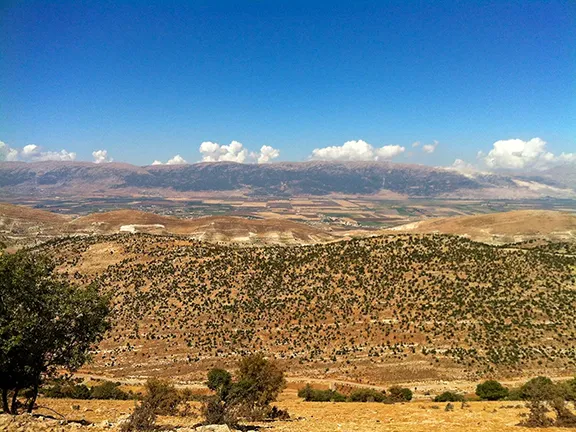 5: The 3.2k yr BP Event