Ancient Mediterranean Shipyards and Harbours
The Harbour at Ro-She Khufu (2580 – 2500 BC) and the Diary of Merer
Explore the Diary of Merer and the Ro-She Khufu harbour. Learn how Inspector Merer and Vizier Ankhhaf managed logistics for Khufu's Giza construction projects.
By Nick Nutter on 2025-12-17 | Last Updated 2025-12-21 | Ancient Mediterranean Shipyards and Harbours
This article has been visited 5,260 times
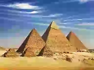
The Giza Plateau
How ancient logs and a lost port reveal the logistics of the Great Pyramid
It is exciting when activities that happened in the far distant past can be linked to one person, especially if that person made a record for posterity. With that in mind, allow me to introduce you to a man called Merer.
Do you enjoy my articles? For your reading pleasure, this website does not carry third party ads. You could help me write more articles by buying me a cup of coffee.
Who was Merer?
Merer was a middle-ranking Egyptian official with the title of Inspector (sḥḏ). He was responsible for a team (a "phyle") of approximately 40 men.
He was what we might call today a logistics manager. His job was to oversee the transportation of the fine white limestone used to build the Great Pyramid of Giza, as well as Khufu’s causeway, the Upper Pyramid Temple, the enclosure wall, and the Valley Temple.
The Diary of Merer (aka Papyrus Jarf)
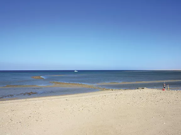
Merer kept a log of his activities. These documents were preserved for over 4,500 years in one of the man-made caves at the Egyptian harbour facility at Wadi al-Jarf on the Red Sea coast. They were discovered in 2013 by a joint French-Egyptian archaeological mission led by Pierre Tallet (Paris-Sorbonne University) and Gregory Marouard.
The Diary is dated to the 27th year of the reign of Pharaoh Khufu (c. 2560 BC). It covers a period of about 5 months, from the season of Akhet (flood) to the early Peret (growth)—in our modern calendar, July to November.
What the logbook tells us
The diary is essentially a day-by-day account of the activities of Merer and his work crew.
The limestone, in blocks weighing two to three tons, was loaded onto transport barges called imu at a quarry called Tura, a few kilometres south of modern-day Cairo on the east bank of the River Nile.
• Capacity: Each barge could carry between 10 and 15 blocks.
• Route: Merer and his phyle hauled blocks from Tura North down to the quay at Tura South. From there, the barge sailed downstream and entered a canal on the west bank of the Nile.
The canal went as far as Akhet-Khufu ("The Horizon of Khufu"), the ancient name for the Giza Plateau. Here, the stone was stockpiled for whatever construction project was underway. Note that the ancients also called the completed Great Pyramid Akhet-Khufu, a confusion that caused media hype suggesting the diary revealed how the pyramid was built—it did not.
Just below the Giza Plateau was a huge artificial harbour installation called Ro-She Khufu. The total distance from Tura to Ro-She Khufu was 15 to 20 kilometres.
The round trip took four days. It is estimated that Merer and his team made 40 to 50 round trips during the five months covered by the diary. Merer was just one logistics manager; there may have been dozens of barges making the journey each week, ensuring a constant supply of stone to the Giza necropolis.
Ro-She Khufu: The Lost Harbour
Ro-She Khufu translates to ‘The mouth of the pool of Khufu.’ It was a man-made basin connected to the Nile by canals.
The pool, or inner harbour, was entered through the ‘mouth,’ thought to be a series of sluice gates that operated as a lock system. Astute readers will note that the stone was being transported during a period when the Nile was in flood.
Why was it built?
Constructed during the 4th Dynasty reign of Khufu (c. 2589 to 2566 BC), it solved the primary logistical challenge: bridging the gap between the Nile and the Giza Plateau. The natural floodplain was too low for heavy transport, so engineers dredged a deep basin to bring 2-ton limestone blocks and 50-ton granite beams directly to the foot of the construction site.
The Engineering of the "Lift"
The Giza Plateau is about 60 metres above sea level, while the harbour installation was at a height of about 15 metres.
• By using sluice gates during the flood, barges could be "lifted" roughly 15 metres until the deck was level with the quay.
• Merer explicitly mentions his crew "opening the dyke" (jnb) or "lifting the piles of the dyke."
Once levelled, levers would be used to pry the block up enough to insert wooden rollers. The blocks were then dragged onto wooden sledges. This method is illustrated on the Colossus of Djehutihotep (c. 1900 BC), a tomb painting showing a massive statue being dragged on a wooden sledge by 172 men.
Recent Discoveries: The Hatnub Ramp
In 2018, archaeologists at the Hatnub alabaster quarry unearthed a ramp with post holes on either side. They surmised that the Egyptians used a system where ropes were wrapped around wooden posts acting as pulleys. This mechanical advantage allowed teams to haul heavy sledges up steep ramps leading away from the harbour quay.
The Scale of the Operation
The harbour was fed by a massive, now-defunct branch of the Nile recently dubbed the Ahramat Branch.
• Width: 200 to 700 metres (similar to the modern Nile).
• Depth: At least 2 to 8 metres.
• The Basin: The central basin (Lake Khufu) was dredged to ~8 metres below the floodplain to prevent heavy barges from running aground during the low-water season.
A massive stone wall, Heit el-Ghurab ("The Wall of the Crow"), stood at the harbour's edge. At 200m long and 10m high, it likely functioned as a dyke to separate the sacred necropolis from the industrial port city.
The Granite Challenge
Although not mentioned in Merer’s account, the transportation of granite was even more demanding. The quarries at Aswan (700km south) were the only source for the rose granite and black granite used in the pyramid chambers.
• A round trip took 1–2 months.
• Barges carried beams weighing up to 80 tons (significantly larger than Merer's limestone barges).
The Administrative Hub
Think of Ro-She Khufu as the central cargo terminal and port authority. It was the interface between the Nile transport network and the construction site. This is where Merer formally delivered his cargo, and where customs officials counted and inspected materials.
Excavations show this "Lost City" was about 7 hectares in area, housing the administrators, workers, and sailors. Merer and his crew stayed here overnight on several occasions.
Who was Vizier Ankhhaf?
The diary solves an ancient mystery. Historians previously believed Ankhhaf was an administrator for the pharaoh who followed Khufu, Khafre. The diaries reveal that Ankhhaf, Khufu’s half-brother, was actually the Vizier (second only to the Pharaoh) and the "Director of Ro-She Khufu" during construction work of the Giza Plateau.
The Imu: Ancient Nautical Engineering
The diary mentions two types of boats:
1. Imu: Heavy transport barges (up to 30m long).
2. Hau: Lighter utility boats.
Both were built using a sewn plank technique. When not in use, the imu could be dismantled into component parts and carried 120km across the desert to Wadi al-Jarf on the Red Sea coast, where they were stored in man-made caverns.
The diaries were likely left behind in these caves by mistake—unlucky for Merer, but extremely fortunate for modern historians.
References
Arnold, Dieter. Building in Egypt: Pharaonic Stone Masonry. Oxford University Press, 1991.
Lehner, Mark. The Complete Pyramids. Thames & Hudson, 1997.
Lehner, Mark. "Giza's Lost Harbor." AERAgram 15, no. 1 (Spring 2014): 2–7.
Lehner, Mark, and Zahi Hawass. Giza and the Pyramids: The Definitive History. London: Thames & Hudson, 2017.
Tallet, Pierre. Les Papyrus de la Mer Rouge II: Le "Journal de Dedi" et autres fragments de journaux de bord (Papyrus Jarf C, D, E, F, Aa). MIFAO 145. Cairo: IFAO, 2021. Tallet, Pierre. Les Papyrus de la Mer Rouge II: Le "Journal de Dedi" et autres fragments de journaux de bord (Papyrus Jarf C, D, E, F, Aa). MIFAO 145. Cairo: IFAO, 2021.
Do you enjoy my articles? For your reading pleasure, this website does not carry third party ads. You could help me write more articles by buying me a cup of coffee.
 1: Egypt's Wadi al-Jarf c 2600 - 2560 BC
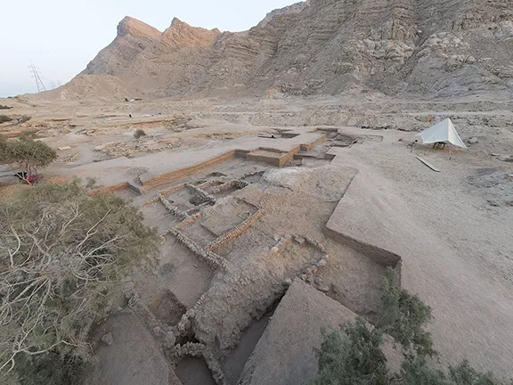 3: Egypt's Ayn Soukhna c 2500 - 1850 BC
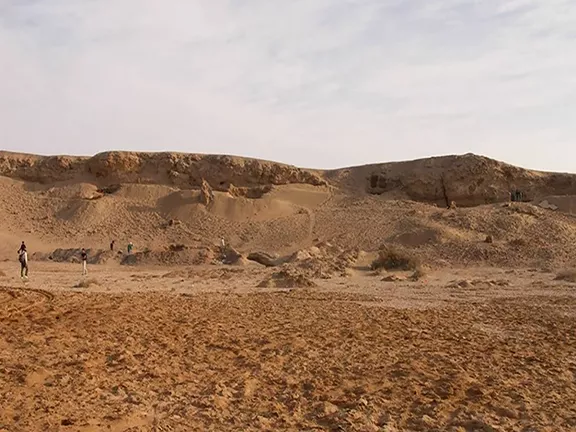 4: Egypt's Mersa/Wadi Gawasis c 2000 - 1500 BC
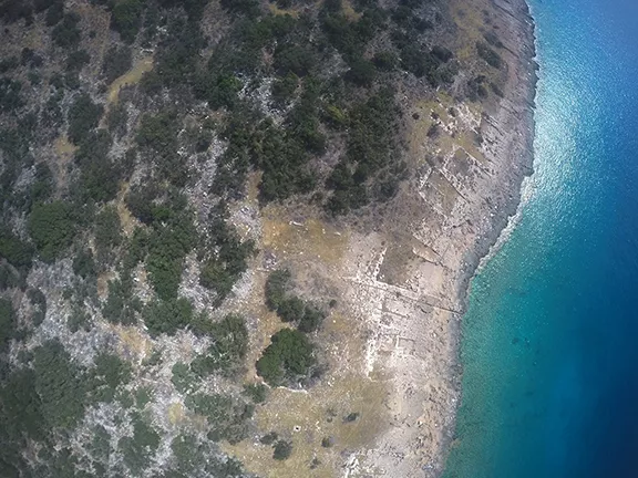 5: Dana Island, Turkey c 800 BC - 700 AD